Hydrology of the Bernese fens
Project Update
Publish date: February 17, 2025

Hydrology of the Bernese fens
Project Update
Publish date: February 17, 2025
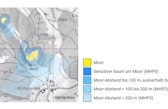
Maintenance of an undisturbed water balance is a key criterion for the long-term protection of fens. As part of this project, researchers created a digital map showing the so-called hydrological precautionary perimeter of Bernese fens, helping cantonal and municipal authorities to ensure the water balance of the estimated 6,300 hectares of remaining fens in the Canton of Bern.
The hydrological precautionary perimeter of the fens provides a tool for leading authorities and specialist agencies to use in the process of issuing building permits. The digital map indicates which areas near protected fens may be important for the water balance.
The map is available on the geoportal of the Canton of Bern and the corresponding data are publicly accessible. Indication of the perimeter is complemented by a set of instructions for permitting authorities as well as a series of information sheets showing what measures can be taken to minimize the impact of construction projects on fens. These documents and additional information may be found on the website of the Canton of Bern.
More information:
Moorhydrologischer Hinweisperimeter (Information about the hydrological precautionary perimeter on the website of the Canton of Bern; available in German and French)
Kartenanwendung moorhydrologischer Hinweisperimeter (Geoportal Canton of Bern; available in German and French)
Moore (Information about peatlands on the website of the Canton of Bern; available in German and French)

Team
- Project contactProject contact
Daniel Bärtschi
Head of Hub Bern
